
Mapping Out Some of Melbourne’s Best Running and Trail Running Routes by Bryan Lim

Melbourne’s pretty good for running. No actually, it’s really good! We are known for the Tan and Albert Park, but there’s so much more on offer in my amazing city. It is such a runnable city, with iconic mixed-used trails such as the Capital City Trail, Anniversary Trail and Gardiners Creek Trail, to name a few. Matt’s instructions to me were clear, and that was to list 5 routes I would love to share, because I might share more of my 90+ saved courses in Garmin Connect.
Route #1 – The Glasshouse Usual – 9km

GPX South Melbourne Life Saving Club
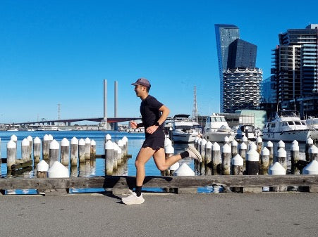
This is my club, Glasshouse Run Club’s Sunday route. We start at South Melbourne Life Saving Club, an award winning public building - I love architecture and there’s no better place to start a run. Importantly for runners, there are clean toilets on offer. We head West, passing by the iconic Princes Pier. We then turn left onto the Webb Trail, hugging the Port of Melbourne before ascending up a ramp that brings us to Sandridge Lookout, which offers one of the best views of the Melbourne skyline.

Heading back, we pass our starting point to run to and up Kerferd Road Pier, which coincidentally acts as the boundary between Albert Park Beach and South Melbourne Beach. It’s an ultra-pleasant 130+ year old pier that is a nice spot to take a breath. It’s a short jog back to South Melbourne Life Saving Club, or to our local breakfast and coffee spot, the Guilty Moose along Victoria Avenue nearby.

Route #2 – Bay Trail – 22km, but really, as short or long as you want it to be

GPX Bay Trail
My usual start point for my long runs along the Bay is at Middle Brighton’s The Baths. You see the trend now… I love starting and ending my runs with a bubbler and public toilet option! The Bay Trail is an epic non-stop mixed use trail that extends all the way from the first route in Port Melbourne all the way to Frankston via the Kananook Creek Trail. That’s close to 50km of dedicated paths. It also makes for a great point to point run, with plenty of public transport options - Brighton Beach station on the Sandringham line, and all stations between Parkdale and Frankston are within a short walk from the trail. For my chosen route however, I have decided to share my usual long run, which is an out and back from Middle Brighton to Beaumaris. What’s great about this section of the trail is that it’s a little quieter than sections closer to town, and with some undulations, you get amazing views across the bay as sections of the trail rise high above the water. In my mapped route, I have included some “off-road” sections of the Bay Trail on the return leg of the run for variation. On easier days, I prefer to run the slower, winding compact gravel trail that parallels the paved mixed-use trail. That’s the beauty of the Bay Trail - there are endless options, and you will never become tired of the views!

Route #3 – Capital City Trail – 30km

GPX Capital City Trail
GPX Yarra River 10km
The Capital City Trail is a Melbourne favourite, and it’s quintessentially Melbourne too with terrible signage! The route I have shared is my current take of the trail, as sections of it around Abbotsford is and will remain closed for the near future. I have also shared a 10km option running on both sides of the Yarra from Federation Square.

I tend to start my run at Kanteen cafe, as it has ample parking and it's just easy to get to from home. Parking along the Tan at Botanical Gardens is another option too. There’s always talk as to which direction is better to run in, but I prefer to get the Southbank part of the way out first before the crowd descends on to the city so a clockwise run is my jam. The Capital City Trail features of 30km of (mostly) dedicated mix use trails, running parallel to the Tan along the Yarra (or you could cross over to the Tan), through Southbank Promenade, Docklands, under the Tullamarine Freeway viaduct, past the Zoo, along what used to be Melbourne’s Inner Circle train line and Studley Park. There are plenty of water and toilet stops along the way and public transport options.
It is truly Melbourne’s central trail as many of the city’s major trails radiate out from it. These include Sandridge Rail Trail (Southbank, which connects to the Bay Trail), Maribyrnong River Trail (Docklands, via Footscray Road), Moonee Ponds Creek Trail (Flemington Bridge), Upfield Shared Path (Royal Park), Merri Creek Trail (Fitzroy North), Main Yarra and Koonung Creek Trails (Fairfied) and Gardiners Creek Trail (Burnley). Suburbs in brackets represent the geographic location of the trail head along the Capital City Trail.
Route #4 – Sky High – 21.5km (Trail, 1100m gain)

GPX Mount Dandenong - Sky High
If you are up for a trail challenge, you will love my usual long trail run, which also happens to be only a 40 minute drive from the city. I first fell in love with the trails of Dandenong Ranges National Park when training for the Roller Coaster Run, so much of my route features segments of the race.

Just like a ride on a roller coaster!
I usually start my run along Doongalla Forest Road, which is a gentle ascent to warm the legs up, before a gradual increase in grade on the Channel 10 and Zig Zag tracks. Heading along the Kyeema Track, Burke’s Lookout along the way is quite possibly the most spectacular lookout point in all of Melbourne, with uninterrupted views all the way to the city and bay on a clear day. The view is much better than Sky High’s at the summit of Mount Dandenong, but you can’t pass up on the opportunity to sit on a giant chair there! After Sky High, the run along Ridge Track brings you to Kalorama and the Silvan Dam lookout (two lookouts in one run, you can’t get better than that). A descent follows along Singleton Terrace… and for the less faint-hearted, there is the option to climb the infamous or famous, depending on person, Scar or Glasgow Trail featuring 307m of elevation gain over 800m, and a max gradient of over 50%. Heading down Zig Zag, Dacite, Rankin and Camelia Tracks, you have the option to tap out along Doongalla Forest Road (where we started), but there’s nothing like adding one of Melbourne’s most well known climbs to the run. Enter, Dodd’s Track, a mile long climb averaging a gradient of 16.5%. A rewarding 2km descent via Ridge Track follows, and is the perfect way to end the roller coaster of a run.

Route #5 – Churchill National Park – 13.5km (Trail, 400m gain)

GPX Churchill NP
GPX Lysterfield Lake Loop (8.5km)
For an easier outing, I love the undulating and non-technical trails of Churchill National Park, also only a 40 minute drive from the city . Churchill National Park connects seamlessly to the much flatter Lysterfield Park on its eastern boundary, which means you can run endlessly across the two parks. I have included a shorter and flatter Lysterfield Lake loop route above.
On my Churchill route, Trig Point Lookout is the highlight with spectacular views. You also get to run along the boundary of the park overlooking Boral quarries, but the best part about Churchill is that you are almost guaranteed to run alongside nature on every run as it has a large population of Eastern grey kangaroos and Swamp wallabies. In the warmer months, beware of snakes. I’ve chanced upon Red-bellied black and Eastern brown snakes on the trail on separate occasions.

Images & words by Bryan Lim

0 Comments
There are no comments for this article. Be the first one to leave a message!